We stock the boards, sensors and modules this project needs. A full parts list is coming soon — for now, browse our DIY Kits & components or search for ESP32 parts.
This project is sourced from another site, not written by us — this list is our best match of their components against what we stock, not a verified bill of materials. Always check the original blog (linked above) for the actual parts list before buying.
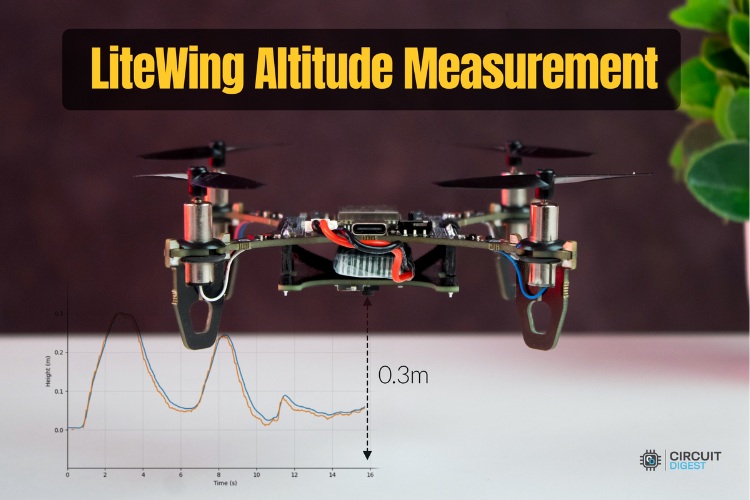
The LiteWing Flight Positioning Module integrates a VL53L1X Time-of-Flight (ToF) sensor to measure precise height relative to the ground. The ToF sensor works by emitting infrared laser pulses and calculating the exact time of flight for the light to bounce back from a target surface, translating this time into an accurate distance measurement. This positioning data is acquired by a compatible drone flight controller running module-compatible firmware, which then relays the telemetry data over a wireless network via an ESP32 or ESP32 DevKit v1 board with Wi-Fi capability. On the receiving end, a connected PC runs a Python environment utilizing specialized libraries. Specifically, the cflib library handles communication, while the LiteWing Python SDK scripts fetch the incoming telemetry stream. Developers can then visualize the real-time altitude data graphically using Matplotlib or interact with it through a custom graphical interface built with Tkinter. This integrated hardware-software architecture allows undergraduate engineers to bridge embedded sensor data acquisition with desktop telemetry tracking, supporting automated flight behaviors such as altitude holding and precision landing.
Why Build This
Develop practical competence in integrating optical Time-of-Flight sensors with flight controller firmware for UAV telemetry.
Implement real-time data streaming pipelines from an ESP32-based microcontroller to a desktop Python environment.
Utilize professional visualization and GUI libraries like Matplotlib and Tkinter to monitor dynamic physical measurements.
Real-World Application
Autonomous drone altitude holding, indoor positioning, obstacle detection, and precision landing for UAVs.
Skills You'll Learn
Time-of-Flight sensor integration
UAV telemetry streaming
Wi-Fi microcontroller communication
Python-based data logging
real-time data visualization with Matplotlib
GUI development with Tkinter
Safety Precautions
Ensure the drone's propellers are removed or the vehicle is secured during bench testing and firmware verification to prevent accidental injury.
Technology Tags
PYTHON
TIME-OF-FLIGHT
VL53L1X
TKINTER
MATPLOTLIB
CRTP
SENSOR FUSION
DRONE TELEMETRY
Frequently Asked Questions
The VL53L1X uses Time-of-Flight technology to calculate precise distance and height measurements by timing how long it takes for emitted light to reflect off the ground.
The ESP32 provides Wi-Fi connection capability, allowing the positioning module to stream real-time flight telemetry data wirelessly to a remote PC.
You need a Python environment with specific packages installed, including cflib, LiteWing SDK scripts, Tkinter for interface elements, and Matplotlib for real-time plotting.
Gallery
This page is part of Kitkraft's Project Hub — a curated collection of electronics & robotics projects gathered from the maker community to help students and hobbyists discover and learn to build. Kitkraft does not claim authorship of the original project, and makes no representation as to the accuracy, completeness or safety of third-party source material. The summary and "How It Works" explanation above are AI-generated, rewritten with reference to the original tutorial — not a reproduction of it. Full credit and a direct link to the original source are provided above. If you're the original creator and have a concern about how your work is represented here, please contact us and we'll address it promptly.
Kitkraft Project Hub — curated from the maker community, credited at the source.