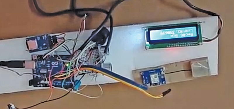
Portable Ultrasonic Trench Logger For Optical Fibre Cable
A portable, Arduino-based device that combines ultrasonic distance measurement with GPS location tagging to automatically log optical fibre cable trench depths onto an SD card.
Parts You'll Need
This project is sourced from another site, not written by us — this list is our best match of their components against what we stock, not a verified bill of materials. Always check the original blog (linked above) for the actual parts list before buying.
-
 Arduino UNO R3 Board (Compatible) – ATmega328P Microcontroller with USB Cable
Rs. 999.00
-
 Ultrasonic Sensor Module HC-SR04
Rs. 89.00
-
 16×2 LCD Display with Pre-Soldered I2C Adapter
Rs. 399.00
-
 2-Slot 18650 Holder with Protective Cover and On/Off Switch – Case
Rs. 109.00
-
 Piezo Buzzer (Big) 6-12V
Rs. 45.00
-
 Jumper Wire 10 Pin Male To Male 20cm
Rs. 45.00
-
 MB102 Adjustable Breadboard Power Supply Module (3.3V & 5V) for Arduino & Raspberry Pi
Rs. 139.00
-
 400 Points Mini Solderless Prototype PCB Breadboard High Quality
Rs. 89.00
-
 Jumper Wire 10 Pin Male To Female 20cm
Rs. 45.00


We don't carry yet: Battery (generic / unspecified)
GPS Module
SD Card Module
Custom PCB / PCB Fab
Screws / Nuts / Standoffs / Hardware
EEPROM / Memory IC
How It Works
Why Build This
Real-World Application
Skills You'll Learn
Safety Precautions
Technology Tags
Frequently Asked Questions
Gallery
This page is part of Kitkraft's Project Hub — a curated collection of electronics & robotics projects gathered from the maker community to help students and hobbyists discover and learn to build. Kitkraft does not claim authorship of the original project, and makes no representation as to the accuracy, completeness or safety of third-party source material. The summary and "How It Works" explanation above are AI-generated, rewritten with reference to the original tutorial — not a reproduction of it. Full credit and a direct link to the original source are provided above. If you're the original creator and have a concern about how your work is represented here, please contact us and we'll address it promptly.