This project is sourced from another site, not written by us — this list is our best match of their components against what we stock, not a verified bill of materials. Always check the original blog (linked above) for the actual parts list before buying.
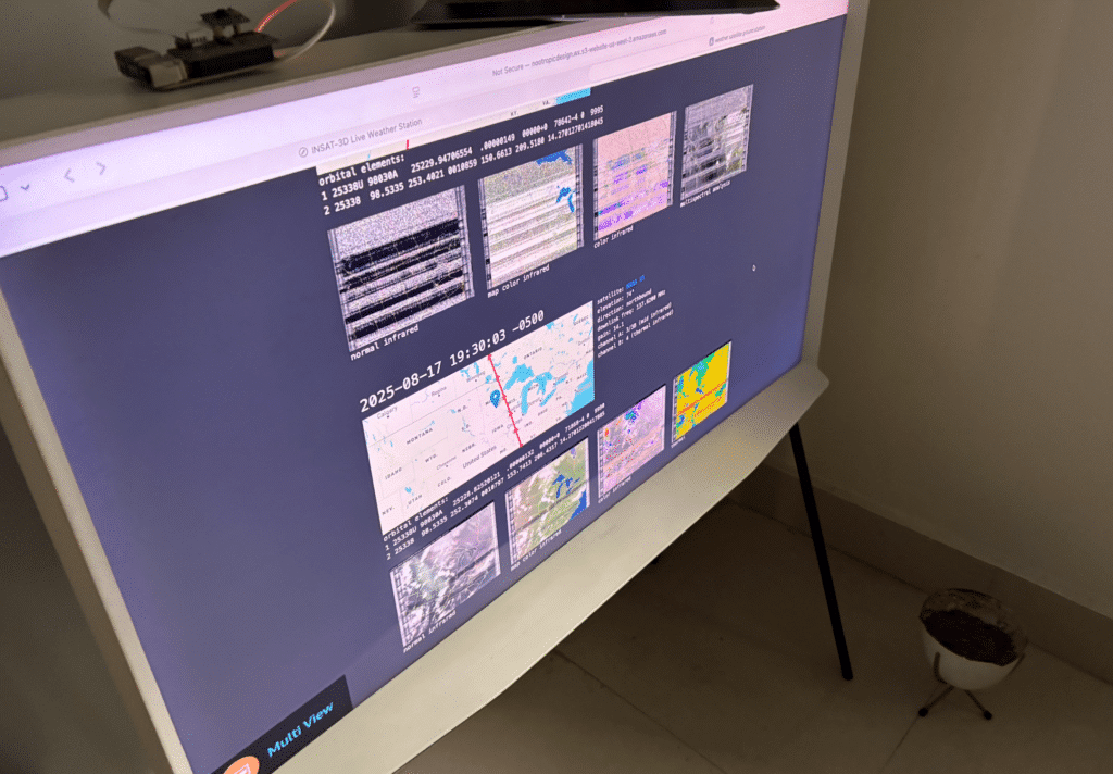
The Simple Weather Satellite Station functions as a complete radio frequency reception and decoding pipeline, transforming invisible overhead satellite transmissions into viewable meteorological images. At the heart of the system is a V-dipole antenna kit mounted outdoors, which is specifically tuned to capture radio frequency signals broadcast by passing weather satellites. This analog radio signal travels down through a coaxial cable (RG58 or RG174) into an RTL-SDR dongle connected via a USB extension cable to the Raspberry Pi 4 Model B. The RTL-SDR acts as a software-defined radio, digitizing the incoming radio frequency band and converting the analog wave into digital data streams. Running on the Raspberry Pi's 16GB+ microSD card, specialized software including RTL-SDR drivers and satellite tracking applications use real-time TLE (Two-Line Element) orbital data to predict when satellites will pass overhead. When a satellite comes into range, the software tunes to the correct frequency, demodulates the incoming signal, and processes the decoded telemetry packets. Finally, the system maps the decoded data into a 2D image, allowing undergraduate engineering students to observe real-time environmental data collected directly from space.
Why Build This
Gain hands-on experience with radio frequency (RF) reception, signal processing, and software-defined radio (SDR) principles.
Apply orbital mechanics and TLE data decoding to track real-time satellite trajectories and passes.
Build a functional meteorological monitoring station capable of capturing live environmental data and weather images from space.
Real-World Application
Meteorological monitoring, weather forecasting, environmental data collection, and satellite communication tracking.
Skills You'll Learn
Software-defined radio operation
RF signal demodulation
satellite tracking using TLE data
antenna tuning and coaxial cable routing
Python-based data processing
Safety Precautions
No specific precautions noted for this build — always follow general electronics safety practices.
Technology Tags
RASPBERRY PI
RTL-SDR
SATELLITE COMMUNICATION
RF RECEPTION
PYTHON
AWS S3
WEATHER SATELLITE
QPSK
ANTENNA
Frequently Asked Questions
An internet connection is helpful initially to download up-to-date TLE orbital data and install software packages, but once configured, the system can operate offline using local calculations.
Coaxial cables provide shielded transmission lines that minimize signal loss and prevent external radio frequency interference from degrading the weak satellite signals before they reach the RTL-SDR dongle.
While older models might physically run some components, the Raspberry Pi 4 Model B (4GB+ RAM) is strongly recommended because heavy signal processing, demodulation, and image decoding require substantial processing power and memory.
Gallery
This page is part of Kitkraft's Project Hub — a curated collection of electronics & robotics projects gathered from the maker community to help students and hobbyists discover and learn to build. Kitkraft does not claim authorship of the original project, and makes no representation as to the accuracy, completeness or safety of third-party source material. The summary and "How It Works" explanation above are AI-generated, rewritten with reference to the original tutorial — not a reproduction of it. Full credit and a direct link to the original source are provided above. If you're the original creator and have a concern about how your work is represented here, please contact us and we'll address it promptly.
Kitkraft Project Hub — curated from the maker community, credited at the source.
 Raspberry Pi 3 - Model B+ 1.4Ghz 64-bit quad-core Processor with 1 GB Ram (Original)
Rs. 5,400.00
 Jumper Wire 10 Pin Male To Male 20cm
Rs. 45.00
 400 Points Mini Solderless Prototype PCB Breadboard High Quality
Rs. 89.00
 MB102 Adjustable Breadboard Power Supply Module (3.3V & 5V) for Arduino & Raspberry Pi
Rs. 139.00
 Jumper Wire 10 Pin Male To Female 20cm
Rs. 45.00


