This project is sourced from another site, not written by us — this list is our best match of their components against what we stock, not a verified bill of materials. Always check the original blog (linked above) for the actual parts list before buying.
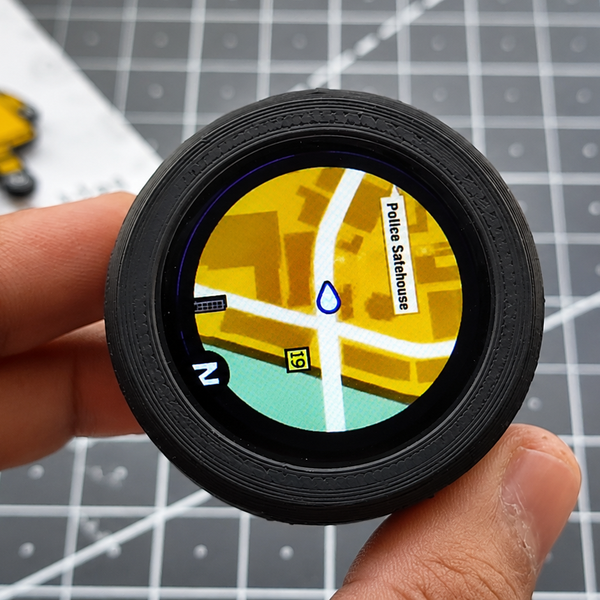
The StrideCity Interactive GTA Map operates as a portable navigation and tracking system powered by an ESP32 microcontroller paired with a GPS module and a display screen. At its core, the ESP32 serves as the central processing unit, running custom firmware developed through the Arduino IDE. As the user moves through the physical environment, the integrated GPS module continuously receives signals from navigation satellites to determine real-time geographic coordinates, including latitude, longitude, and velocity. The ESP32 parses these incoming NMEA data sentences via serial communication, translating raw positional data into localized coordinates suited for the project's game-like visual framework. Once processed, the microcontroller renders a dynamic graphical interface onto the attached display screen, mimicking the aesthetic and functionality of an open-world video game minimap. By refreshing the display in real time based on the user's physical displacement, the system bridges the physical and digital worlds, creating an engaging, gamified visualization of real-world travel without requiring complex server-side infrastructure.
Why Build This
Design and deploy custom embedded graphical user interfaces using microcontroller-driven display hardware.
Implement real-time geolocation tracking algorithms by interfacing GPS hardware modules with the ESP32.
Develop custom firmware in the Arduino IDE to parse serial data streams and map physical movement to interactive virtual coordinates.
Real-World Application
Gamification of fitness, interactive walking/running trackers, and creative wearable or portable navigation displays.
Skills You'll Learn
GPS data parsing
serial communication (UART)
embedded graphics rendering
microcontroller firmware development
coordinate mapping algorithms
Safety Precautions
No specific precautions noted for this build — always follow general electronics safety practices.
Technology Tags
ESP32
MAPS
INTERACTIVE DISPLAY
GPS
FITNESS TRACKING
Frequently Asked Questions
No, the GPS module communicates directly with overhead navigation satellites to determine your position, so an active internet connection or cellular data plan is not required.
This project specifically targets the ESP32 DevKit v1 due to its robust processing power, multiple hardware serial ports, and sufficient memory required to handle both GPS data parsing and display rendering simultaneously.
You will use the Arduino IDE on a computer, connecting to the ESP32 via a USB cable to compile and flash the custom code directly onto the microcontroller's flash memory.
Gallery
This page is part of Kitkraft's Project Hub — a curated collection of electronics & robotics projects gathered from the maker community to help students and hobbyists discover and learn to build. Kitkraft does not claim authorship of the original project, and makes no representation as to the accuracy, completeness or safety of third-party source material. The summary and "How It Works" explanation above are AI-generated, rewritten with reference to the original tutorial — not a reproduction of it. Full credit and a direct link to the original source are provided above. If you're the original creator and have a concern about how your work is represented here, please contact us and we'll address it promptly.
Kitkraft Project Hub — curated from the maker community, credited at the source.
 ESP32 WiFi+Bluetooth CP2102 Development Board
Rs. 520.00
 400 Points Mini Solderless Prototype PCB Breadboard High Quality
Rs. 89.00
 MB102 Adjustable Breadboard Power Supply Module (3.3V & 5V) for Arduino & Raspberry Pi
Rs. 139.00
 Jumper Wire 10 Pin Male To Male 20cm
Rs. 45.00
 Jumper Wire 10 Pin Male To Female 20cm
Rs. 45.00


